HISTORIX Vintage 1885 Brooklyn Bridge Map - 26x38 Inch Light Walnut Framed Vinta
Shipping options
Seller handling time is 2 business days Details
This reflects the seller's handling time and may not include time spent in transit.
If you have questions about shipping, please contact the seller.
FREE via to United States
Return policy
Full refund available for DOAs
Details
- We guarantee our products and offer full refunds or exchange for defective items or items not as-described.
- Buyer must contact us within 30 days after receipt of shipment.
- The item must be received in the same condition as shipped.
- Items must be returned with all original packaging and accessories.
- Items must not be abused, modified or damaged by accident.
- A 20% restocking fee will be charged for returns
- Buyer is responsible for all return shipping and handling fees.
- Restocking and return shipping fees do not apply when item is returned as defective or because incorrect product was delivered.
Payment options
PayPal accepted
PayPal Credit accepted
Venmo accepted
PayPal, MasterCard, Visa, Discover, and American Express accepted
Maestro accepted
Amazon Pay accepted
Nuvei accepted
Item traits
| Category: |
Books & Magazines
|
| Quantity Available: |
8 in stock
|
| Condition: |
New
|
| ASIN: |
B099ZPP2XJ
|
| EAN: |
0693634000548
|
| UPC: |
693634000548
|
| color: |
Light Walnut Frame
|
| Externally Assigned Product Identifier: |
0693634000548
|
| Item Shape: |
Rectangular
|
| Bullet Point: |
View details
VINTAGE MAP FRAMED: You’ll love this high-quality light walnut framed historic reproduction of 1885 Brooklyn Bridge Map. Our ready-to-hang maps are printed and framed in the USA by professional art framers using the highest quality materials. Each...
|
| Product Description: |
View details
Officially renamed the Brooklyn Bridge in 1915, this depiction produced by Currier & Ives was published only two years after construction was completed. Opened on May 24, 1883, this was the first fixed crossing across the East River and would b...
|
| brand: |
HISTORIX
|
| Unspsc Code: |
55101500
|
| Item Name: |
View details
HISTORIX Vintage 1885 Brooklyn Bridge Map - 26x38 Inch Light Walnut Framed Vintage New York Brooklyn Bridge Poster - Bird's Eye View of Great East River Suspension Bridge New York City Map
|
| Item Type Keyword: |
artwork
|
| Product Site Launch Date: |
2021-07-21T08:17:22.753Z
|
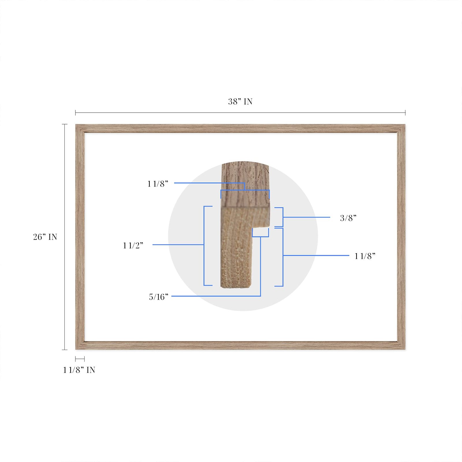
| size: |
26x38 Inch
|
| material: |
Plastic
|
| style: |
Vintage
|
Listing details
|
Seller policies:
|
View seller policies
|
|
Shipping discount:
|
Seller pays shipping for this item.
|
|
Posted for sale:
|
More than a week ago
|
|
Item number:
|
1736377341
|
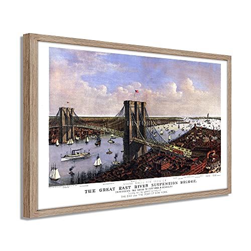
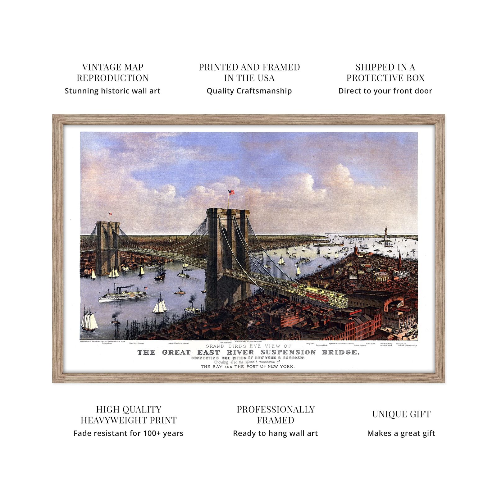
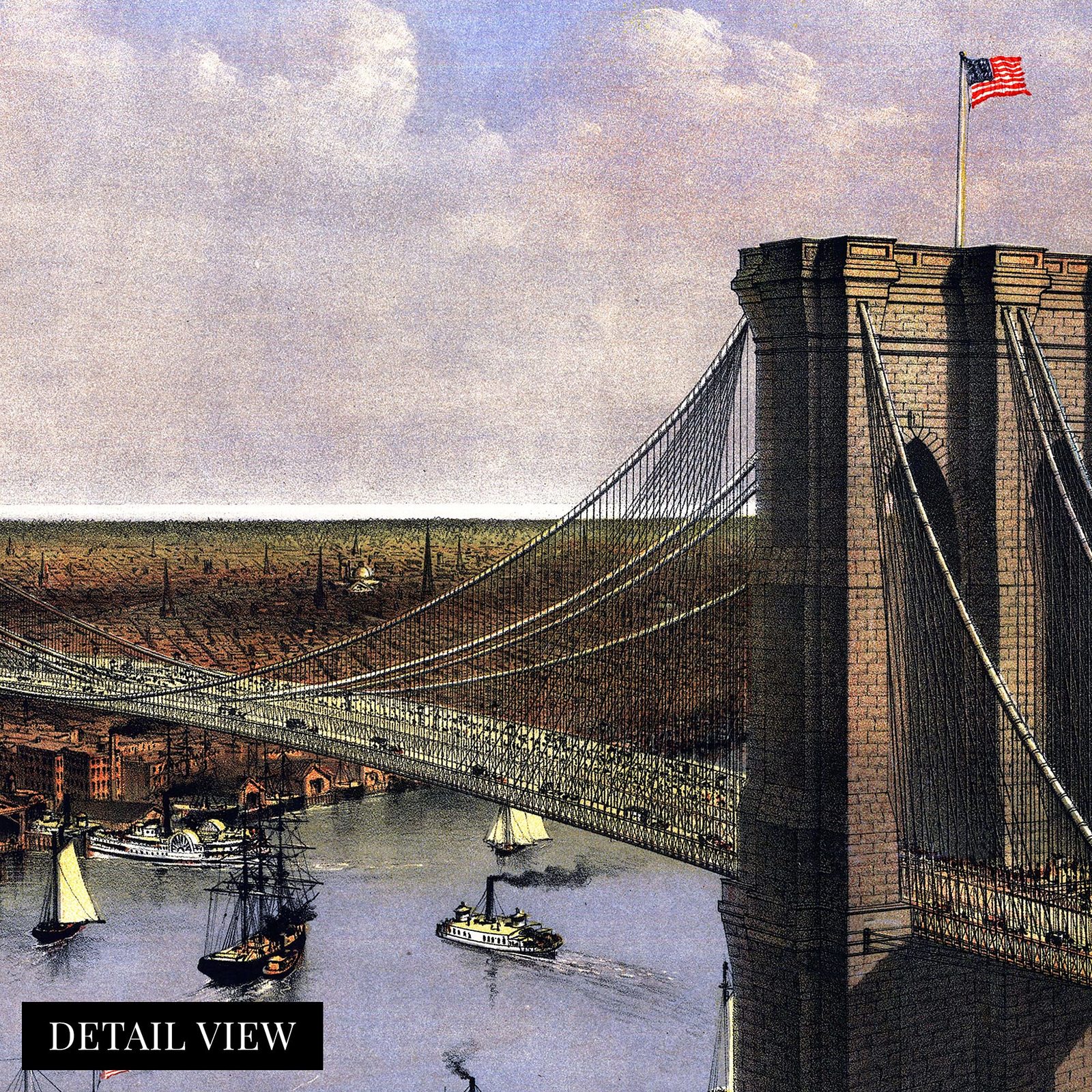
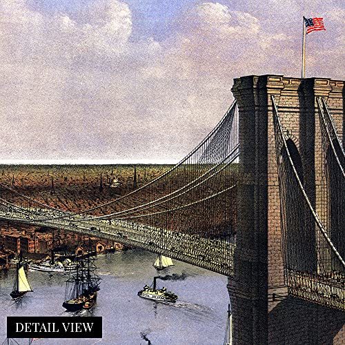
Officially renamed the Brooklyn Bridge in 1915, this depiction produced by Currier Ives was published only two years after construction was completed. Opened on May 24, 1883, this was the first fixed crossing across the East River and would become a true icon of not only New York City, but the United States. Currier Ives were prolific producers of these birds' eye perspectives, which served as a vehicle for residents and merchants alike to display their civic pride.
This was the world's first major steel-wire suspension bridge, and it's immediately recognizable Neo-gothic stone towers have been featured in art and literature since its opening. The bridge was a feat of civil engineering of the time and would lay the groundwork for other iconic suspension bridges, including the Golden Gate.
Traffic across the bridge was robust and more than a million people crossed in the first six months alone, with this number increasing to 17 million in the year this map was published. The distinctive aesthetic of this map immediately transports the viewer back in time and is a truly authentic piece of cartographical history.
The Statue of Liberty that greeted the throngs of immigrants stands proudly in the background, and many notable places are indexed on the map. The panorama illustrates the bustling bay and shows the transition from traditional sailing vessels to steamships. By connecting the boroughs of Manhattan and Brooklyn, the city was nearing consolidation and becoming what would be recognizable today.
Our ready-to-hang wall art are printed and framed in the USA using the highest quality materials with professional craftsmanship. This beautiful artwork is a perfect addition to your themed decor. Historic prints look great in the home, study or office. They also make an unforgettable gift.
Additional Details
------------------------------
Bullet point: VINTAGE MAP FRAMED: You?ll love this high-quality light walnut framed historic reproduction of 1885 Brooklyn Bridge Map. Our ready-to-hang maps are printed and framed in the USA by professional art framers using the highest quality materials. Each order is inspected for quality. This beautiful artwork is a perfect addition to your themed decor. Vintage maps look great in the home, study or office. They also make an unforgettable gift.
Product description:
Officially renamed the Brooklyn Bridge in 1915, this depiction produced by Currier Ives was published only two years after construction was completed. Opened on May 24, 1883, this was the first fixed crossing across the East River and would become a true icon of not only New York City, but the United States. Currier Ives were prolific producers of these birds' eye perspectives, which served as a vehicle for residents and merchants alike to display their civic pride.
This was the world's first major steel-wire suspension bridge, and it's immediately recognizable Neo-gothic stone towers have been featured in art and literature since its opening. The bridge was a feat of civil engineering of the time and would lay the groundwork for other iconic suspension bridges, including the Golden Gate.
Traffic across the bridge was robust and more than a million people crossed in the first six months alone, with this number increasing to 17 million in the year this map was published. The distinctive aesthetic of this map immediately transports the viewer back in time and is a truly authentic piece of cartographical history.
The Statue of Liberty that greeted the throngs of immigrants stands proudly in the background, and many notable places are indexed on the map. The panorama illustrates the bustling bay and shows the transition from traditional sailing vessels to steamships. By connecting the boroughs of Manhattan and Brooklyn, the city was nearing consolidation and becoming what would be recognizable today.
Our ready-to-hang wall art are printed and framed in the USA using the highest quality materials with professional craftsmanship. This beautiful artwork is a perfect addition to your themed decor. Historic prints look great in the home, study or office. They also make an unforgettable gift.