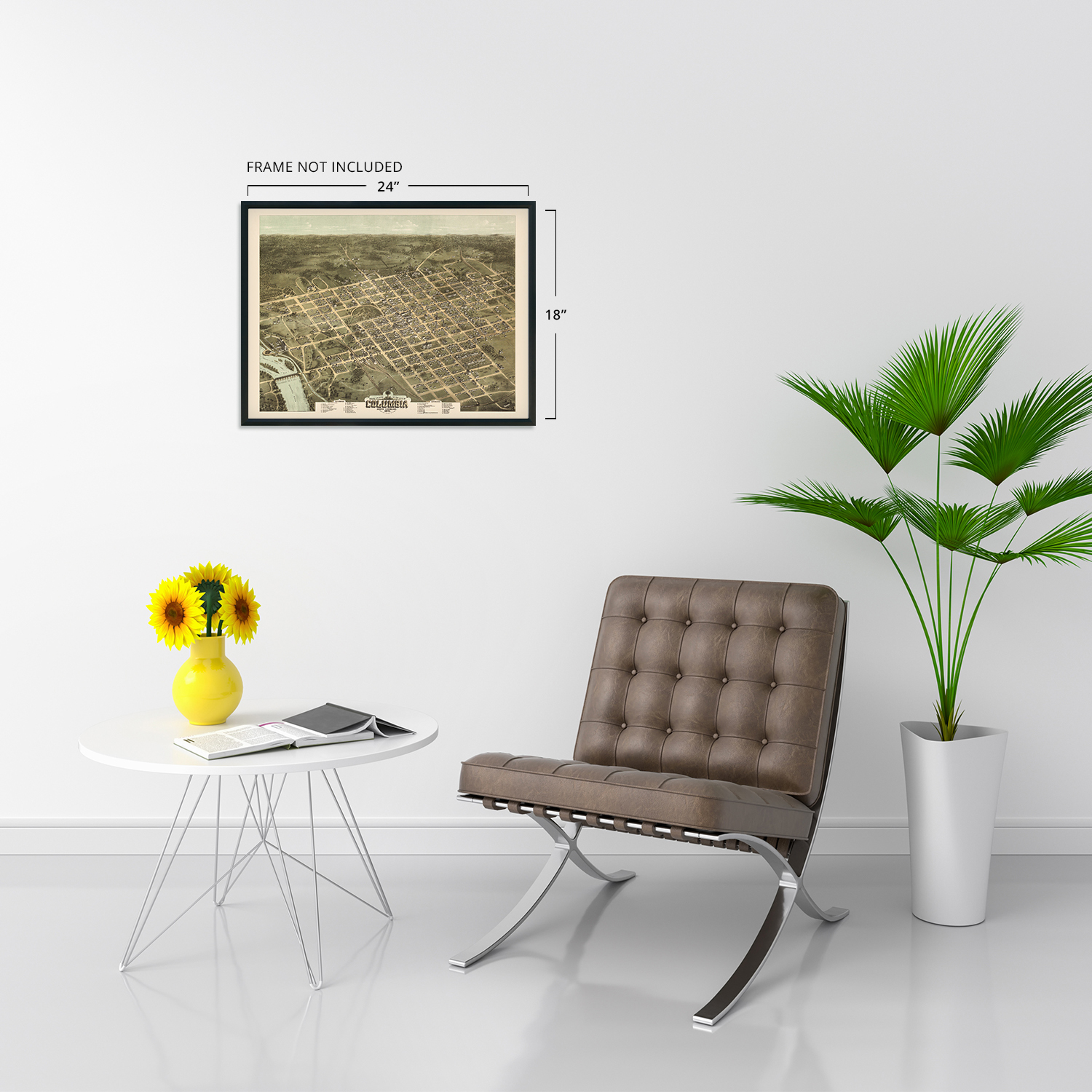
1872 Columbia South Carolina Bird's Eye View Map - Vintage Wall Art Decor Print
Shipping options
Seller handling time is 2 business days Details
This reflects the seller's handling time and may not include time spent in transit.
If you have questions about shipping, please contact the seller.
FREE in United States
Return policy
Full refund available for DOAs
Details
- We guarantee our products and offer full refunds or exchange for defective items or items not as-described.
- Buyer must contact us within 30 days after receipt of shipment.
- The item must be received in the same condition as shipped.
- Items must be returned with all original packaging and accessories.
- Items must not be abused, modified or damaged by accident.
- A 20% restocking fee will be charged for returns
- Buyer is responsible for all return shipping and handling fees.
- Restocking and return shipping fees do not apply when item is returned as defective or because incorrect product was delivered.
Payment options
PayPal accepted
PayPal Credit accepted
Venmo accepted
PayPal, MasterCard, Visa, Discover, and American Express accepted
Maestro accepted
Amazon Pay accepted
Nuvei accepted
Item traits
| Category: |
Art Prints
|
| Quantity Available: |
16 in stock
|
| Condition: |
New
|
| Subject: |
Maps
|
| Style: |
Vintage
|
| Type: |
Wall Art
|
| Features: |
Museum Quality
|
| Theme: |
Vintage
|
| Artist: |
Various
|
| Region of Origin: |
Made in the USA
|
| Brand: |
HISTORIX
|
| Sizes: |
View details
18x24 Inch (8 in stock)
24x30 Inch (8 in stock)
|
Listing details
|
Seller policies:
|
View seller policies
|
|
Shipping discount:
|
Seller pays shipping for this item.
|
|
Posted for sale:
|
More than a week ago
|
|
Item number:
|
1738798331
|
HISTORIX Vintage 1872 Columbia South Carolina Map Poster - Vintage Map of Columbia SC Wall Art - Old Columbia SC Map - Historic Bird's Eye View Map of Columbia SC Poster
Features
VINTAGE MAP REPRODUCTION: You'll love this high quality historic reproduction of 1872 Columbia Map. Our museum quality maps are archival grade, which means it will look great and last without fading for over 100 years. Our print to order maps are made in the USA and each map is inspected for quality. This beautiful artwork is a perfect addition to your themed decor. Vintage maps look great in the home, study or office. They make a perfect gift as well.
MUSEUM QUALITY: This high quality map print will be a great addition to your vintage-themed wall. Don't waste money on cheap-looking, thin paper posters. We use thick, fine art print quality matte paper. Our professional's choice matte paper displays artwork in high detail without glare. The color is vibrant and the text is easy to read. When framed, this map looks absolutely stunning.
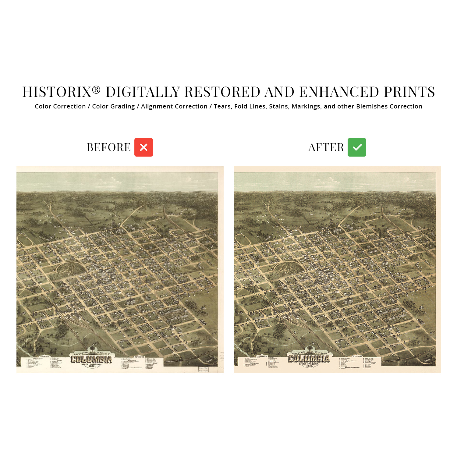
A LOOK BACK AT HISTORY: This is an impressive, historic reproduction of 1872 Map of Columbia SC. This print is from an original found in the maps and geography division of the US Library of Congress. A true piece of history. See our product description section for more fascinating information about this historic map and its significance.
READY TO FRAME: This print includes a 0.2 inch border for a perfect frame fit and look. Our maps are designed to fit easy-to-find standard frame sizes, saving you money from having to pay for a custom frame. Each map is inspected for quality and shipped in a rigid tube.
HISTORIX: We love history and art. Sometimes old maps have tears, folds, separations and other blemishes. We digitally restore and enhance maps while keeping its historical character. All our maps are proudly made in the USA. Customers all over the world love our vintage maps and we know you will too.
Additional Information
Produced and published by the prolific American cartographer C.N. Drie this unique depiction of South Carolina's State Capital shows it in a period of significant growth and transformation following the conclusion of the American Civil War. Much of Columbia had been burned in the last days of the conflict, and the rebuilding process was completed mainly by the publication of this map. Bird's eye perspectives were wildly popular during the late nineteenth century and would remain so until the 1920s. These unique illustrations bear a distinctive aesthetic and style that immediately transports the viewer back in time, creating an indelible link and connection to the past.
Columbia's rich history and geographic location at the confluence of the Saluda and Broad River allowed it greater access for goods to flow West and North. As the State Capital, Columbia is the center of politics for the State and has been since 1786. When the Santee Canal was completed in 1800, access to the thriving port in Charleston allowed the city to expand. This access attracted numerous immigrants from Western Europe, England, and Ireland. These immigrant communities established neighborhoods along cultural lines, many of which exist to this day.
Drie's illustrations are included in the Library of Congress, and his works are considered among the best of the era. The years following the end of the Civil War were pivotal to the development of Columbia's status in the South, and it became one of the most iconic Southern cities.
Our museum quality giclee print comes printed with archival ink on premium heavyweight matte paper. Shipped in a sturdy cardboard tube your print will arrive ready to be framed. This eye-catching vintage map reproduction print makes the perfect gift for anyone that loves history and imagery.