Proseries Wall Map: Colorado State (R) and 41 similar items
Free Shipping
PROSERIES WALL MAP: COLORADO STATE (R)
$266.31
View full item details »

Shipping options
Estimated to arrive by Thu, Sep 4th.
Details
FREE via UPS Ground (1 to 5 business days) to United States
Return policy
Replacement product available within 30 days
Details
Purchase protection
Payment options
PayPal accepted
PayPal Credit accepted
Venmo accepted
PayPal, MasterCard, Visa, Discover, and American Express accepted
Maestro accepted
Amazon Pay accepted
Nuvei accepted
View full item details »
Shipping options
Estimated to arrive by Thu, Sep 4th.
Details
FREE via UPS Ground (1 to 5 business days) to United States
Return policy
Replacement product available within 30 days
Details
Purchase protection
Payment options
PayPal accepted
PayPal Credit accepted
Venmo accepted
PayPal, MasterCard, Visa, Discover, and American Express accepted
Maestro accepted
Amazon Pay accepted
Nuvei accepted
Item traits
| Category: | |
|---|---|
| Quantity Available: |
Only one in stock, order soon |
| Condition: |
New |
| Country/Region of Manufacture: |
United States |
Listing details
| Seller policies: | |
|---|---|
| Posted for sale: |
More than a week ago |
| Item number: |
737226805 |
Item description
PROSERIES WALL MAP: COLORADO STATE (R)
DESCRIPTION
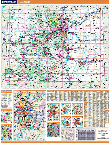
Rand McNally's regional wall map of Colorado is ideal for anyone needing a comprehensive representation of the area for planning, routing, or reference. It's a great choice for business and sales strategy, urban development, social work outreach, education, and marketing. Colorado residents, businesses, and government offices are sure to find this wonderful reference tool irreplaceable.
The laminated wall map is printed with UV-resistant ink to help prevent color fading.
Map details include state highways, federal highways, county highways, county boundaries, city shading, cities and towns, major waterways, state/national parks, campsites, exit numbers, rest areas, military installations, airports, golf courses, universities, and much more.
You'll also find a city/county index on the map and a driving times map between major cities in the region.
This truly complete wall map even includes a hanging kit with rails for easy mounting just about anywhere.
COVERAGE AREA
Inset maps include: Boulder; Colorado Springs; Denver Vicinity; Denver downtown; Fort Collins; Greeley; Pueblo; Mesa Verde National Park; and Rocky Mountain National Park.
PRODUCT DETAILS
Dimensions: 60" x 46";
Scale: 1" = approximately 9.5 miles.
|
Why are we showing these items?
Search Results
Map, transportation"map" Category "Transportation"
|


-
Refine your browsing experience
We can show you more items that are exactly like the original item, or we can show you items that are similar in spirit. By default we show you a mix.
This item has been added to your cart
 PROSERIES WALL MAP: COLORADO STATE (R) added to cart.
Only one available in stock
PROSERIES WALL MAP: COLORADO STATE (R) added to cart.
Only one available in stock
View Cart or continue shopping.
 Please wait while we finish adding this item to your cart.
Get an item reminder
We'll email you a link to your item now and follow up with a single reminder (if you'd like one). That's it! No spam, no hassle.
Already have an account?
Log in and add this item to your wish list.